Short Label:
41
Long Label:
41
Description:
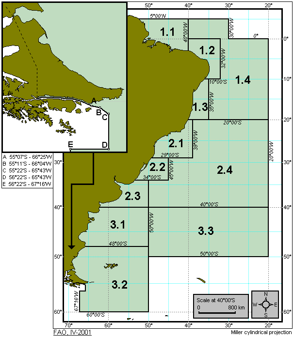
The Southwest Atlantic statistical area comprises all the marine waters bounded by a line starting from a point on the coast of South America at 5°00'N latitude; thence due east to 30°00'W longitude; thence due south to the Equator; thence due east to 20°00'W longitude; thence due south to 50°00'S latitude, thence due west to 50°00'W longitude; thence due south to 60°00'S latitude; thence due west to 67°16'W longitude; thence due north to the point at 56°22'S latitude - 67°16'W longitude; thence due east along a line at 56°22'S latitude to the point at 65°43'W longitude, thence following a line joining the points at 55°22'S - 65°43'W, 55°11'S - 66°04'W, 55°07'S - 66°25'W; thence in a northerly direction along the coast of South America to the starting point.
Map Image: