Short Label:
81
Long Label:
81
Description:
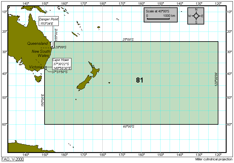
All marine waters of the Southwest Pacific bounded by a line commencing from a point on the eastern coast of Australia at the boundary between the States of New South Wales and Queensland at 28°09'S latitude; thence due east to 155°00'E longitude; thence due north to 25°00'S latitude; thence running due east along this parallel to 120°00'W longitude; thence due south to 60°00'S latitude; thence running due west along this parallel to 150°00'E longitude; thence due north along meridian 150°00'E to 37°31'50''S latitude; thence in a rhumb line in a westerly direction to meet the coast of Australia at the boundary between the States of New South Wales and Victoria at Cape Howe at 37°30'22''S latitude and 149°58'30''E longitude; thence due north along the coast of New South Wales to the point of departure.
There are no subdivisions of the Southwest Pacific (Major Fishing Area 81) that are recognized for the collection of STATPAC catch and effort data.
Map Image: